Lucky Boy Vista
/Trek Date: September 16th, 2013
Next time you’re in Joshua Tree National Park, be sure to set aside two hours and hike the “out and back” Lucky Boy Vista Trail. It’s a hike where the reward (the vista) far outweighs the price (effort expended to get there). This trail is on my Top Five list of short hikes in JT.
The trail head is located on the dirt road that leads from Park Boulevard to the Desert Queen Mine/Pine City trail head and parking area. Keep your eyes open for the very small turnout on the east side of the road and the tiny trail head marker. If you reach the larger parking area for the Desert Queen Mine, turn around and head back about .5-mile.
The Lucky Boy Vista trail is a 2.5-mile round-trip hike rated as easy, and it is. You won’t even break a sweat unless you hike it during the coyote days of summer and in the middle of the day like I did. But even then, the trek is a treat. The elevation gain is a modest 200 feet over 1.25 miles and for the most part the trail follows along an old mining road or jeep track. It’s a very pleasant walk in the park with no worries about getting lost, as no other trails intersect to confuse things.
The first section of the trail is Queen Valley at its best. The path was smooth and level, with Joshua trees, yuccas, piñon pines, cactus and boulders, oh yes boulders, as my only traveling companions. A rabbit dashed across my path and I knew lizards were watching me. But I didn't run into another person while on the trail and you probably won’t either. As close as it is to well-traveled areas of the park, I was able to enjoy the desert solitude and become one with the sand.
After a while the trail started to rise and dip in elevation a bit and about one mile in I came to a gate. It was propped open, but even if it had been closed I could have just walked around it, as there is no fence on either side. My guess is it was originally placed to keep vehicles from traveling farther up the road.
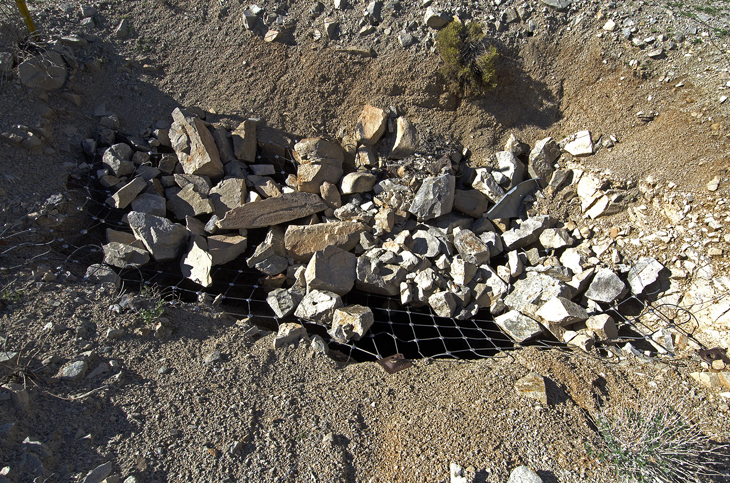
As I approached the Vista, I was several large dumps of tailings, so I knew I had reached the remains of the Elton Mine. Naturally, I veered off the trail to check them out. The Elton Mine was a gold mine that ceased operations during the 1930s. There’s not much to see anymore, not even the usual piles of rusty tin cans. It seems like the site has been wiped clean, all the machinery and above ground buildings long since gone. What was left to explore were four somewhat fenced in mine shafts with warning signs advising folks to keep their distance. The shafts themselves are covered with wire mesh screen and partially filled in with rocks. The large amount of tailings in front of them leads me to believe that the shafts may have been quite deep. I didn't examine much more than the immediate area, so there may be other shafts or remains scattered about, but that gives me a good reason to come back soon.
Scrambling down the tailings, I made my way back to the trail and continued on about another 100 yards or so to the vista the trail is named for. I've read different descriptions of Lucky Boy Vista, one called it a “modest overlook,” another said it wasn't as good as the view from Negro Hill or Ryan Mountain (4878 ft. and 5457 ft. elevations respectively, well duh) and one called it a “moderate scenic overlook.” They must have been chewing jimsonweed, because when I reached the edge of the plateau, the vista I saw was amazing. A great panorama stretched out before me that included Split Rock almost directly to the east, and a great expanse of desert and rocks both to the north and south of that area. It was very impressive and worth more than the price of the hike.
After taking a lot of pictures and enjoying the view from upon a rock, I started my return trip back down the trail. The scenery slowed me down as it seemed that around every rock or bend in the trail was another photo that needed to be taken. And several small hills that begged to be climbed to see what was on the other side. But sooner than I expected, my truck was in sight and the Lucky Boy Vista adventure was done. Trust me on this one: set aside two hours for this trail the next time you’re in JT and then go see what you can find.
Trailhead 34.017927° -116.082384°
Lucky Boy Vista 34.010352° -116.065078°


