Contact Mine
/There are trillions and trillions of rocks at Joshua Tree National Park and I hiked over many of them on my way to the Contact Mine. At least it felt that way. Big rocks, little rocks, sharp rocks, moving rocks. I also discovered a new sport I call “Rock Surfing.” It’s a spontaneous and unexpected event that occurred several times when I stepped or jumped onto large, flat rocks along the trail that I assumed would not move when I landed on them. Depending on the angle of the trail, I sometimes caught a pretty good scree wave and “surfed” the rocks several feet.
The trailhead for the hike to the Contact Mine is located about one-third of a mile south of the North Entrance gate to the park. At the time of this trek, that entrance was closed due to portions of the road beyond being washed out from the summer monsoons. It’s not yet clear when the road will be repaired and the entrance reopened, so call ahead before trying to enter the park from Twentynine Palms.
The Rangers let me park near the closed entrance and I was able to walk down the road to the trailhead. Let me just insert here, it’s always a good idea to do your homework, research and planning for a new hike BEFORE you start the hike. This trek was a last minute addition to my plans for the day and I didn’t research and plan as thoroughly as I normally do, which resulted in hiking several miles more than I should have. I basically knew where I was heading and what landmarks to look for, but sometimes out in the desert one canyon or wash can look remarkably just like another. Research, then hike. That’s my new mantra. So the rest of this post skips over the first three miles where I missed the turnoff, and begins at the beginning of the four-mile hike as if I hadn't missed the rock cairns marking the turnoffs…..
The Trailhead
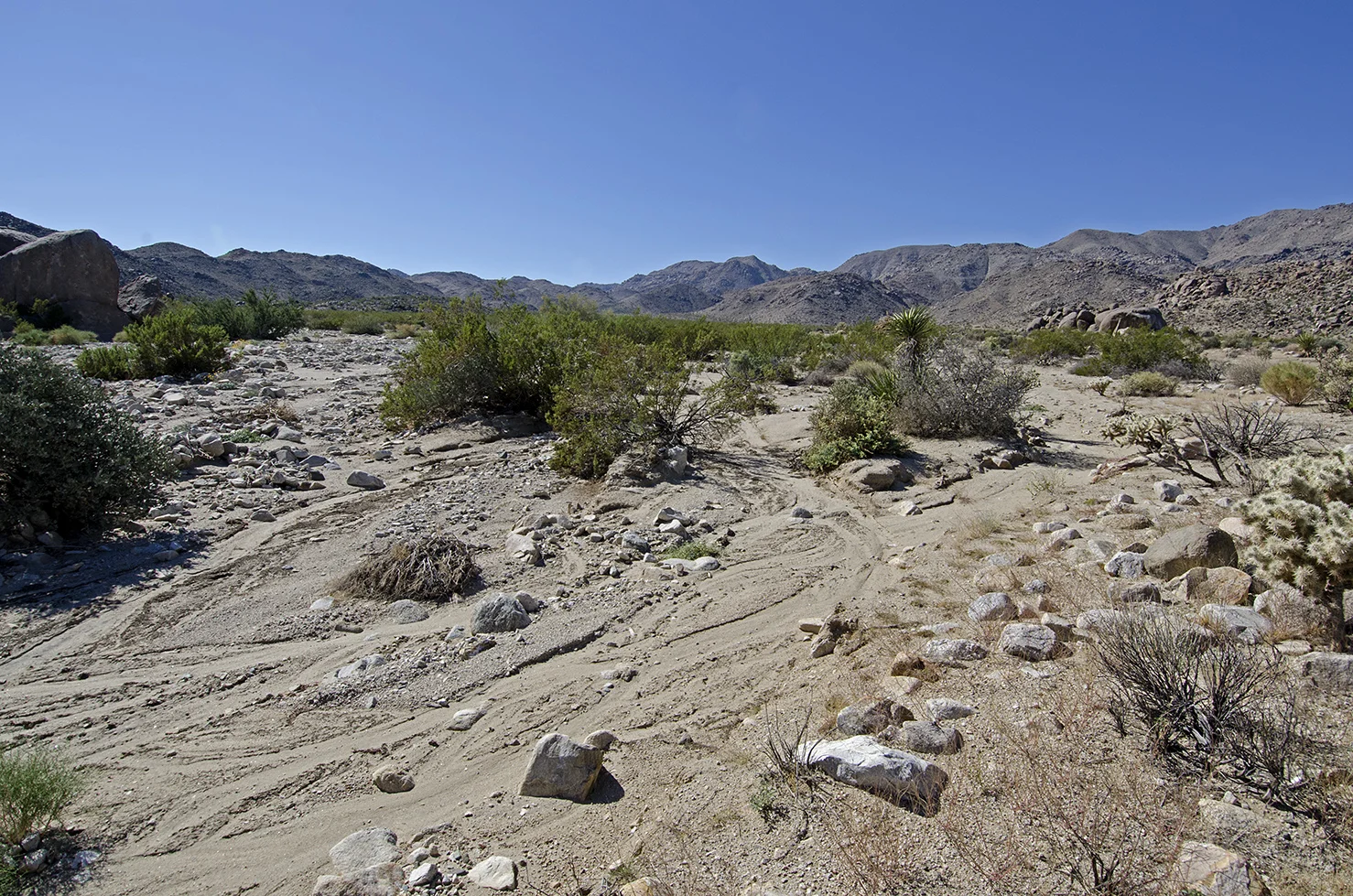
I started my hike at the large information board located at the parking area turnout. Several washes lead up into the canyons from near this area and I was looking for the largest one, which was pretty easy to find. The secret for the first section of this hike, the wash cycle I’ll call it, is to stay on the right hand side of the main wash. I headed up the wash and passed a couple of large-sized hills on my right and a small canyon that lead off to the right as well. After about one-half mile I started searching for the trail markers the Ranger had told me to look for. This is the key to the entire hike, finding the right spot to turn LEFT out of the wash and connect with the old mining road that leads to the Contact Mine. Once you find the road, the trail if pretty easy to follow the rest of the way.
Don't miss these rock cairns!
The Ranger had told me to look for a small pyramid of rocks; actually, I found three. Two very large cairns and one small one, but they all mark the spot where I needed to exit the wash on the LEFT hand (south) side and start following the old mining road that climbs up a small rise and then parallels the left side of the wash as I headed west. Once I found the road, I didn’t lose the trail.
One of the most amazing things to me about this hike is the old mining road. It must have been a huge undertaking to build this road up to the mines. It follows the contours of the hills and along almost its entire length is supported on its downslope side by rock walls. One thing’s for sure, I wouldn’t have wanted to drive a fully loaded wagon or truck down this road.
After following the trail for about a quarter-mile, it headed down into and across the wash, and then started climbing up and along the side of a large hill. From here on there’s really no chance to lose the trail, I just continued following the mining road as it wound around the hills and small canyons following the main wash. Hiking about one-half mile from the wash crossing, I finally rounded a bend in the trail and got my first glimpse of the Contact Mine off in the distance. From here it was only about another quarter mile to the mine.
A historic resource study conducted in the 1980s reported that the Contact and Contact No. 2 lode mining claims had been located on July 1st of 1923. The property was active for several years and gold and silver ore were being mined, shipped and milled at a good profit. It was apparently active during the early 1930s and then again in 1940. By 1953 the mine was owned by a Mr. E.M. Reimiller of Twentynine Palms. The same report, however, also states that Bill McHaney claimed that “Sullivan’s Contact Mine” was in operation by 1910.
It was a bumpy ride.
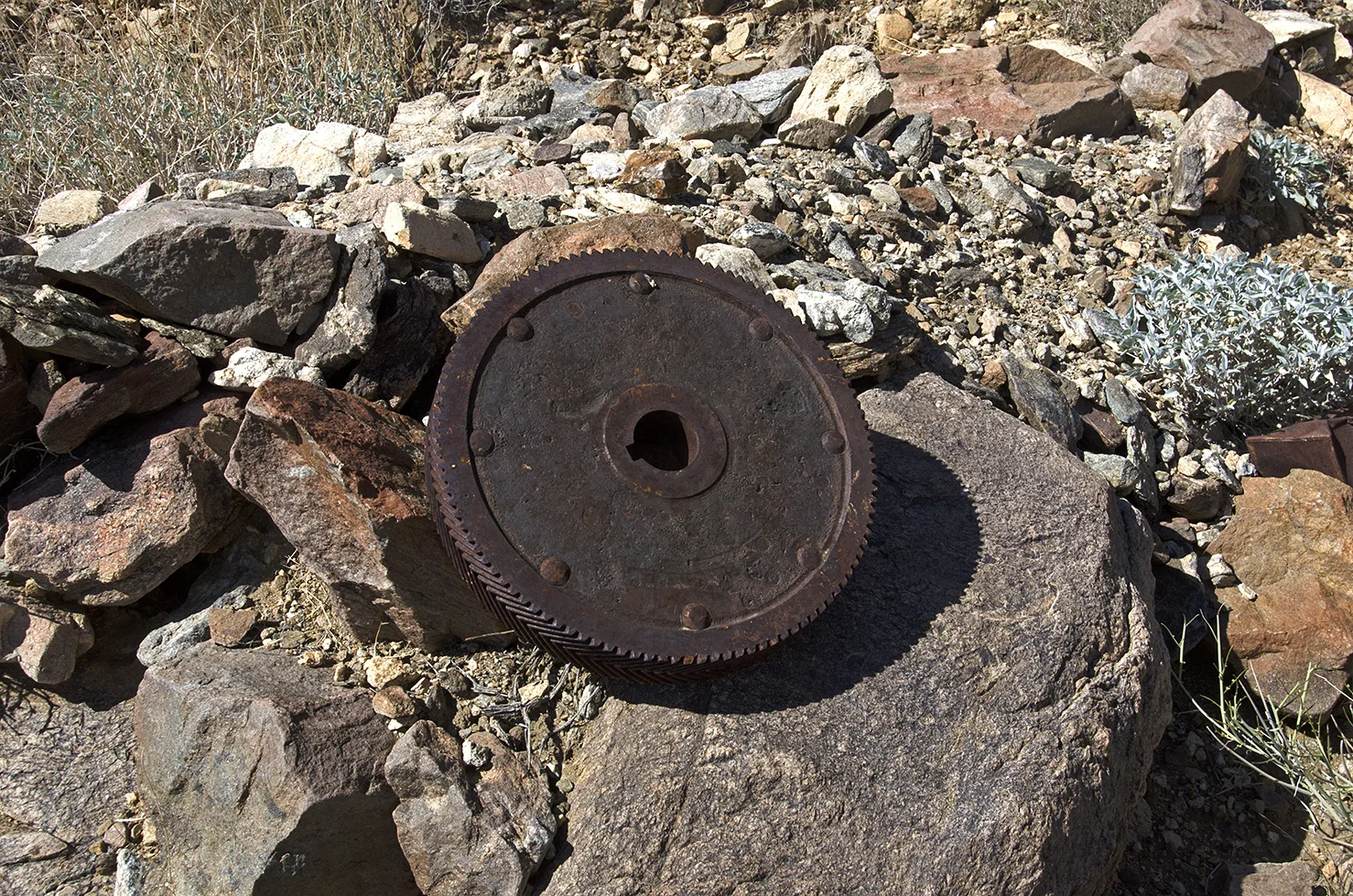
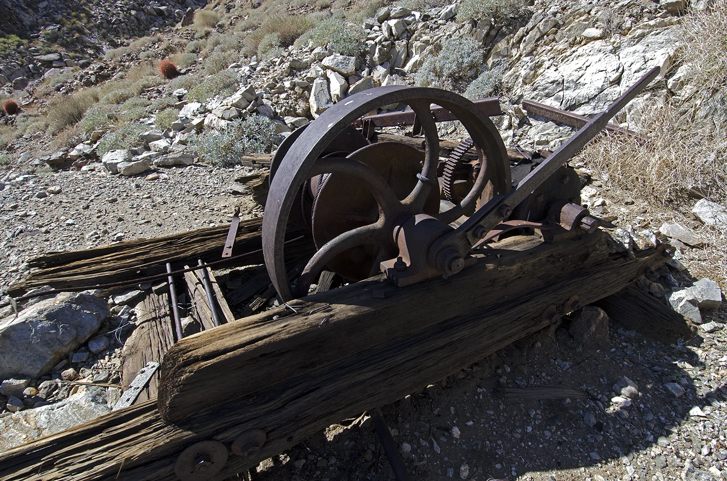
There’s a lot of interesting artifacts to examine at the mine site. Three vertical shafts have been enclosed by metal structures and there are several other smaller cuts nearby. The remains of a winch are located above one of the shafts and an old generator is nearby. Vestiges of a tram track remain, leading from the shafts to the edge of the tailings dump. Bits and pieces of machinery and old camp trash (what I like to call ‘Desert Gold’) are scattered about the nearby rocks and hills.
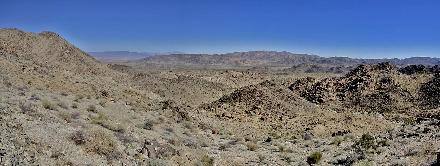
After I had taken my fill of pictures, I gathered up all my gear and began the hike back down the trail. Just a short distance away from the main mine site, I spotted a fenced-off mine high atop a ridge, so had to scramble up and check it out. It appears to be a pretty deep shaft that is timbered, and had part of an old wooden ladder along one side of the shaft wall. I tend to stay away from the sides of these old mine shafts. There is a great view looking east over the valley from up here, that alone would have been worth the climb. It was one my way back down to the trail from this spot that I discovered I was a pretty good “rock surfer.”
As the old saying goes, it was all downhill from then on. There are some great views of the rock walls that were built to support the road heading down the trail and I took a fair share of photos. The only thing to worry about was the hundreds, thousands, tens of thousands of rocks in the road. They were eagerly awaiting the opportunity to twist my ankles, but I prevailed and made it back down without incident. Upon returning to my car, I set out to see what else I could find while the daylight lasted.