Aguereberry Point, Death Valley, Cal

Aguereberry Point, Death Valley, Cal

Aguereberry Point is flat out a contender for the most stunning view in Death Valley National Park. It’s not the highest point in the park, nor the most visited, but it is certainly worth the time to visit.

Read More

Journigan's Mill, Death Valley, Cal.

Journigan's Mill, Death Valley, Cal.

So after surviving my near death experience at Mesquite Flat (read about it HERE), I was looking for higher altitudes, cooler climate and less hiking. I was driving up Emigrant Canyon Road, on my way to the ghost town of Harrisburg and the remains of the Eureka Mine. I'd been up this road before a couple years earlier, when I visited the Wildrose Charcoal Kilns, and I remembered seeing several spots that needed further exploration the next time I was in the area. So I was in the area, and I caught sight of these two large tanks; I pulled over to investigate and I'm glad I did.

Read More

Cave Dwellings of Dublin Gulch, Cal

Cave Dwellings of Dublin Gulch, Cal

Dublin Gulch is located on the southern edge of Shoshone, California. I wasn't able to track down a lot of history on the place, but here are some generalities which are most likely accurate. The caves are dug into solidified volcanic ash that reportedly came from a Lava Creek eruption in Yellow Stone National Park, over 600 thousand years ago. One account claims they were dug in the early 1900s, another puts their creation during the late 1870s when a silver boom at the nearby Noonday Mines was in full swing. Regardless of when they were created, they are pretty amazing.

Read More

Rosalie, Cal

Rosalie, Cal

Mining activity in the Clark Mountain Range dates back to the 1860s. It’s likely that prospectors found some color in this desert region, but copper would prove to be the ore to bring prosperity to the area. A man by the name of Johnny Moss is credited with discovering the Copper World mine in 1868, which he wouldn’t have known to look for if a Piute chief hadn’t given him a chunk of metallic copper.

Read More

Death Valley Mine, Cal

Death Valley Mine, Cal

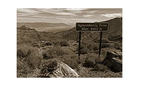
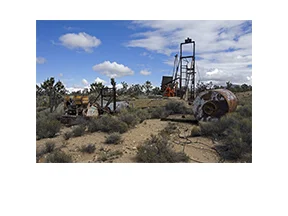
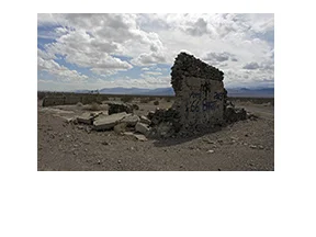
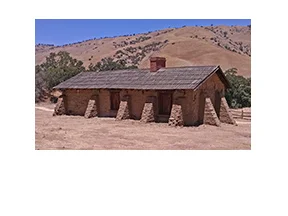
So the first thing to say about the Death Valley Mine is, it's not located in Death Valley.

A man by the name of J.L. Bright discovered the Death Valley Mine in 1906, why he chose that name is anyone's guess, as the location was some 70 miles from Death Valley.

With the prospect of gold or silver, it wasn't long before a mining camp known as Dawson sprung up nearby. Named after the directors of the Death Valley Milling and Mining Company of Denver (who had bought the property from Bright shortly after his discovery), the inhabitants of Dawson worked not only at the DVM, but at other mines in the area as well.

Read More

Rt 66 - Siberia, Cal

Rt 66 - Siberia, Cal

You don't need a visa to go to Siberia. At least, the one in California. You will need to use some mapping skills and your imagination though, to get there.

Siberia was originally founded as a water stop and rail siding for the Sante Fe Railroad, which later also became a motorist stop for travelers along Route 66. It was located between Bagdad and Ludlow and must have had some years of minor prosperity. Cafes and tourist camps operated here during the 1930s and 1940s, but things never quite took off.

Read More

Yermo, Cal

Yermo, Cal

The name "Yermo" is derived from the Spanish word for "Wilderness." Which seems appropriate. Out in the Mojave Desert, with the Calico Mountains to the north, the area must have seemed quite desolate when it was first settled. The town was once known as "Otis," after Gen. Harrison Gray Otis, a wealthy land and mine owner in the area. The Postal Service changed the name to Yermo in 1905, possibly due to a rift between Otis and the local miners union, legend claims.

Read More

Fort Tejon, Cal

Fort Tejon, Cal

Ok, next time you're driving over the Grapevine, take the exit and stop to visit Fort Tejon State Historic Park. I know you've seen the signs and wondered what it was all about. It'll take you less than an hour to walk the grounds and check out what's there. It's pretty cool.

Read More

Salton Sea - Desert Shores

Salton Sea - Desert Shores

I drove through Desert Shores recently, mainly to take some pictures of what is left of a resort near the water's edge. I'm not sure yet if it was part of the Desert Shores Yacht Club, or maybe the Marina Mobile Estates, but the remains of whatever it was are still impressive. I'll bet it was something to see back in the day. The attraction of old, abandoned places seems to have a hold on me.

Read More

Salton Sea - Bombay Beach

Salton Sea - Bombay Beach

The Salton Sea is actually the largest lake in California. It was created by accident in 1905 when a cut in the bank of the Colorado River resulted in an overflow that overwhelmed the canal which was supposed to contain the runoff. The river basically flowed unchecked into the historic dry lake bed of the Salton Basin for two years before repairs were completed. Oooops. Things happen.

Read More

Rt 66 - Tucumcari, NM

Rt 66 - Tucumcari, NM

As soon as I drove into Tucumcari, it was plain to see that this town must have been one of the premier towns of old Route 66. There are traces of those glory days on each side of 66, all through town. From neon signs to old cafes and motels, it's definitely a photographer's dream. But I'm going to start this post with a spot I stopped at a little west of town, south of I-40 at Exit 321.

Read More

East Jesus

East Jesus

I recently had the opportunity to meet up with my cousin, Karen of the North Country, at the Salton Sea Visitor Center.  There are a lot of interesting things and places to visit in the Sonoran Desert of southeastern California, and we had the entire day to see what we could find. Our travels eventually led us to East Jesus, which curiously enough, is located near West Satan.

Read More