Split Rock Trail
/Trek Date: April 6th 2014
I recently had the opportunity to practice my trail guide skills, as my uncle Phil and aunt Margaret were staying in 29 Palms for a few days, while on a road trip far from home. They were looking forward to exploring J Tree, so after a nice brunch at the 29 Palms Inn, we headed out on a windy Sunday morning to see what we could find.
I thought the Split Rock Trail would be a great hike to start with, even though I'd never been on it before. I'd heard about some of the interesting things to see along the trail, and at roughly 2-1/2 miles roundtrip, I figured it would be perfect.
As with so many spots in J Tree, well-known landmarks can be totally deceiving when viewed from different angles. Above is the rock the picnic area and trail are name for, as viewed from the southwest. A few steps to the east, however, and it's apparent how the place got its name.
Split Rock marks the trail head and we chose to hike the loop counter-clockwise. The trail is fairly well marked along its entire route, with an occasional sign post pointing the correct direction where needed. Had the rock not been split in two, the trail may have been known as "Cave Rock Trail," as there is a pretty nice-sized cave under the rock.
The cave is a nice, cool spot to rest and I'm sure that many folks have taken advantage of that fact over the years. It's not hard to imagine earlier peoples camping at this spot.
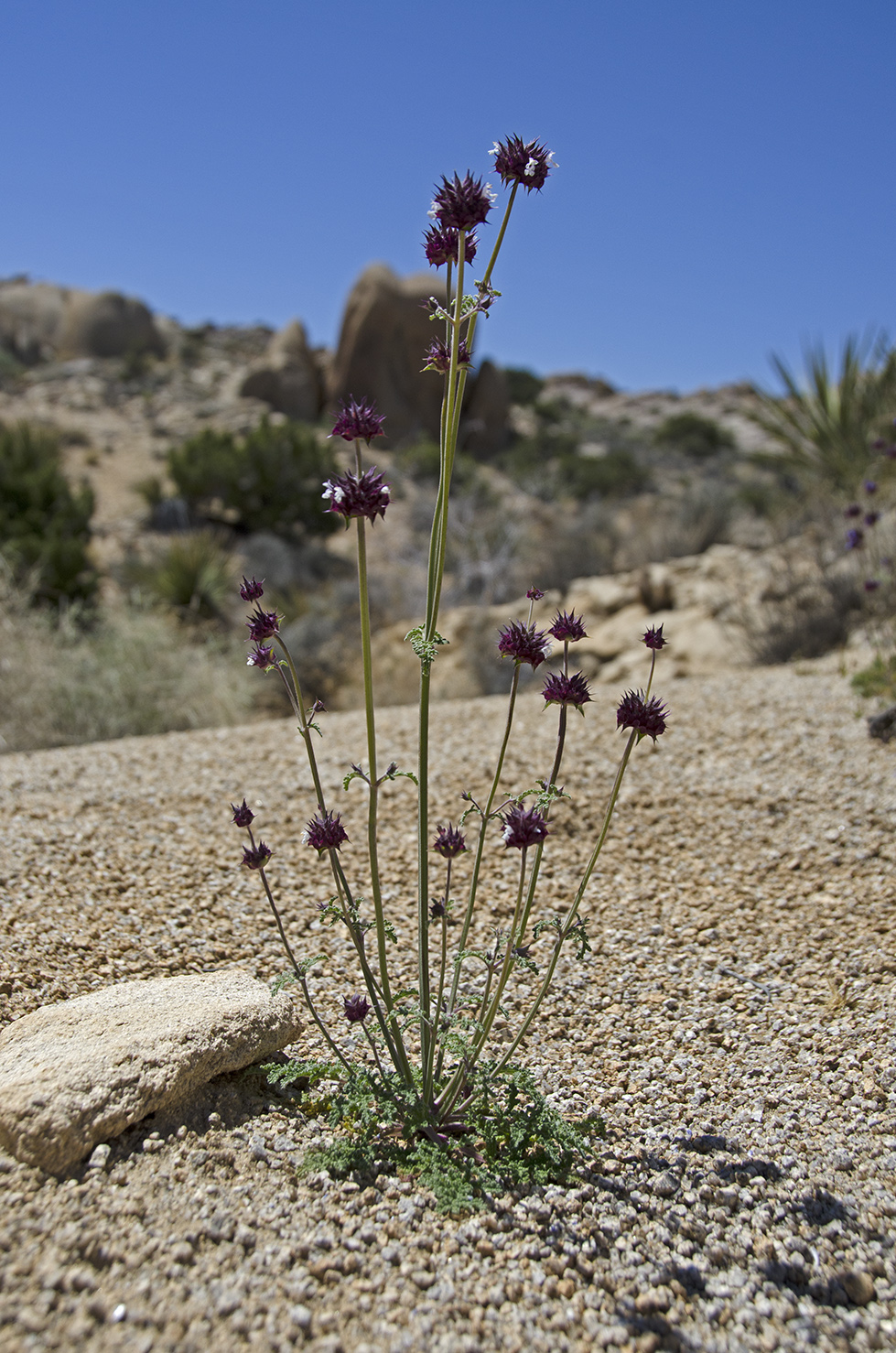
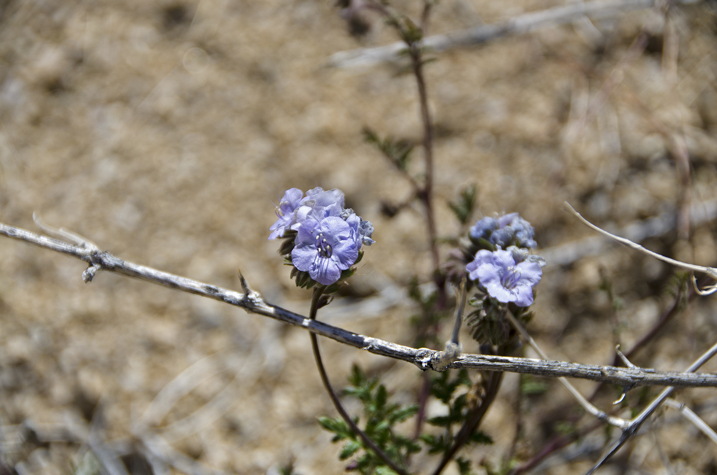
The trail heads out across some rock boulders, dirt paths and passes in and amongst many very interesting boulder piles. We enjoyed the greenery and the many different wildflowers that were in bloom (stay tuned for the wildflower gallery at the end of this post). The only slight drawback to the day? It was quite windy, but while walking through the rocks, draws and washes, it often became very still as we were sheltered by our surroundings.
We had fun naming many of the rock formations we passed. Can you spot "The Claw" in the photo above?
At several strategic spots along the trail, where there might be a question as to which way to go, the park service has left us clues. Thank you, Mr. Ranger.
We passed this pretty little wash that had a lot of greenery. The water must really come roaring down this canyon during a good rainstorm. I'd certainly like to see that sometime, from a safe vantage point above the wash.
This giant Prickly Pear cactus stands guard in the wash, it's seen its share of flash floods over the years.
We passed by a lot of mistletoe along the trail. This one was really showing off.
A little farther along the trail, after crossing the wash, we started to climb a bit and this pretty view of the canyon, rock piles and hills out in the distance opened up. Split Rock is visible up in the top right corner.


This is one of the main "named" rocks along the trail. I had seen a picture of it in one of the trail guide books, and had been keeping a sharp lookout for it. Viewed from the north, east and west, it looks like any other rock, but from the south you can see why it's called "Tulip" Rock.
Orangutan Rock. How long has it kept watch? For some reason, I think of Planet of the Apes when I look at this picture.
When we reached the 1.3 mile point, the trail crossed a medium-sized wash. From here, the route turns sharply to the east for the return part of the loop trail back to the parking area. But there are some interesting things to see about a tenth of a mile south along this wash, so that's the way we went.
This old cement water trough must be a relic of the days when cattle periodically grazed this area. It's in pretty good shape and has a metal pipe entering at the north end. There must have been a tank somewhere higher up along the wash that stored water after it rained, which would have fed water into the trough. Phil and I each searched a bit for the tank, but weren't able to spot it.
A short distance south of the water trough, we found Face Rock. After admiring this stoney visage and talking with some other hikers, we headed back up the wash to the Split Rock trail junction and headed east toward the parking area. We still had a bit of hiking in front of us, and the trail goes through some amazing boulder areas, filled with Pinyon pines, scrub Oaks and lots of Yucca and other desert shrubs.
Little Arch Rock, way atop a pile of boulders. I could have climbed up for a better look, but decided to leave that for the younger hikers.
Brain Rock sits high atop a huge chunk of granite, on the opposite side of the canyon from Little Arch Rock.
We were approaching the end of our hike when we found this nice spot along the trail. Those are some big Pinyon pine trees and they provided a nice shady spot to take a rest. Throughout the day we had passed several groups of hikers and it seemed like everyone was enjoying the day.
I think I'm going to have to call this spot Juniper Gulch. One of the great things about wandering through the boulder mazes in J Tree is that you never know what you're going to find. All of a sudden the trail will round a corner and a beautiful view like this one will open up before you. What a perfect view to end a hike with. We had a great time along the Split Rock Trail and I managed to not get us lost, that's job security.
All along the trail we had passed lots of wildflowers showing off their colors, here are some of my less blurry images.